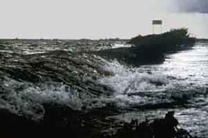
In 1421 a combination of a North Westerly storm, together with a spring tide, caused the dykes surrounding the Groote of Zuid Hollandsche Waard (The Great or South Hollands Polder) to break, resulting in large-scale flooding of this once rich agricultural land. This disaster, named after the patron saint of that fateful day, St. Elisabeth, caused the loss of some 60,000 ha of rich and prosperous polder land. The sea gained free access to this large area. This combination of sea tides and river sedimentation created a new and unique natural area later to be known as the Biesbosch.
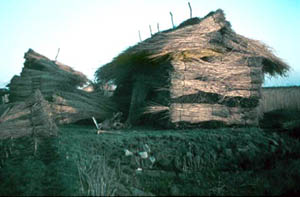
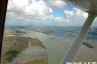
The ensuing years and centuries following the St. Elisabeth flood, a combination of natural and human influences have re-shaped the Biesbosch giving it its now familiar form. Fisheries, aquaculture (bull-rushes, reeds and extensive willow woods) together with numerous duck decoy traps and reintroduction of agriculture by land reclamation, creation of new waterways (Nieuwe Merwede, Bergsche Maas), creation of reservoirs supplying clean water to Rotterdam, have, together with natural processes over 6 centuries, all helped to shape this area and to create the Biesbosch as we now know it.
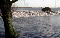
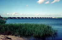
After the serious flooding of 1953 an ambitious plan was carried out by the Dutch government to prevent any further extensive flooding. This work, known as the Delta Plan, involved the closing of the estuaries from the sea. A series of dams and sluices effectively closed of the arms of the sea radically altering the Biesbosch, changing it from a brackish tidal estuary (with a tidal range of 2½ meters) into a fresh water wetland (with a tidal range of ⅓ meter). This has resulted in the development of a unique range of flora and fauna.
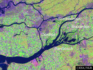
The Dordtse Biesbosch is just one area within a much larger National Park, The Biesbosch.
As has happened in many other countries, increasing awareness of the need to protect areas of natural beauty and diversity, has lead to the creation of National Parks protected under law. The Biesbosch is one of such areas, becoming an official National Park in 1994. Covering an area of some 9,000 ha it is the largest National Park in The Netherlands. The Biesbosch is split into separate geographical zones:-The Brabantse Biesbosch, the Sliedrechtse Biesbosch and the Dordste Biesbosch. The latter covers an area of some 1000 ha. The Biesbosch is a unique natural area being one of the few remaining fresh water wetlands. Due to the importance of the Biesbosch to wildlife habitation, especially breeding birds, large parts of the Biesbosch are protected areas and are not open to the public.
The Dordtse Natuur en Vogelwacht (The Dordtse Nature and Bird Protection Society) is committed to the development of the Dordtse Biesbosch and carries out research projects into both the fauna and flora of the area. The following pages will give the reader an impression of the unique and flourishing wetland that is the Dordtse Biesbosch, together with a cultural and historical record of the events that lead up to the creation of this varied landscape.